


Photo by Lee Vue
The arrival of summer in Minnesota brings dreams of watery idylls. In the Twin Cities, those dreams likely evoke a favorite river or lake in the northern part of the state. And therein lies the rub: Our favorite destinations get too damn crowded during high season. Nothing kills the mood of canoeing a tranquil lake amid loons and the gentle lapping of the water so quickly as a philistine in a $90,000 wakeboard boat, blasting tunes with a 250-watt sound system and throwing tsunami-like waves in your direction.
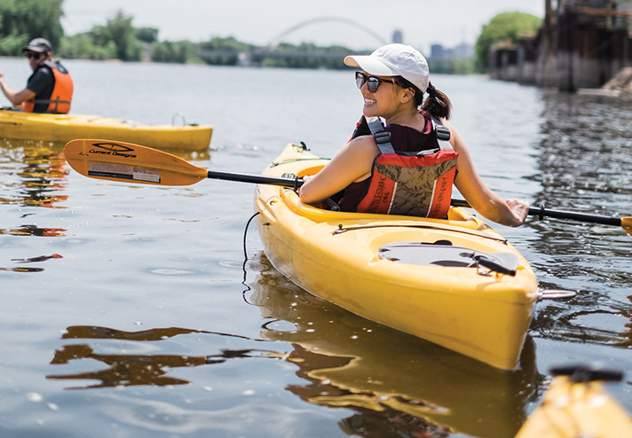
But friends, there is good news. If you want to get out on the water—and you want some elbow room—you don’t need to drive for six hours and then make five portages into the Boundary Waters. You don’t even have to leave the Twin Cities. You need to consider an outing on the 12-mile stretch of the Mississippi River that flows from the Coon Rapids Dam to St. Anthony Falls in downtown Minneapolis.
I have been an evangelist for this under-celebrated run of river since the early 2000s, when I rented space in an old chair factory in northeast Minneapolis. The great virtue of that place was the backyard, which led directly to the river. There was a sand beach where I could store my cheap little fishing boat. I took advantage of this setup and spent a ton of free time exploring the local waters, at all times of day and year.
One of the things that struck me from the outset: the astonishing dearth of boat traffic, even during some of the nicest weekends of summer. Prior to planting my flag in Northeast, I’d explored and fished on the Mississippi quite a bit, but mostly in St. Paul. That is still a working river, full of barge traffic and pleasure boats large and small.

Photo by Brian T. Imagery
A More-Placid Paddle
The river in Minneapolis above St. Anthony Falls is far mellower. In fact, it’s far mellower than it was when I started out with my explorations. Mainly, that’s because the highest-impact user—the Patrick Gannaway towboat, which used to push two barge-loads of sand and gravel to north Minneapolis twice a day—has been absent since 2015. That’s when the U.S. Army Corps of Engineers shut down operations of the upper lock at St. Anthony Falls, which also meant the functional end for the Port of Minneapolis, the other destination for barge traffic in the old days.
Unlike the river in St. Paul, this part of the Mississippi isn’t home to a single marina. There are several boat launches, the best of which is at Boom Island. But none are designed to accommodate large vessels, which are a rarity here. This makes the riverine experience considerably more tranquil for water users in canoes, kayaks, or even smaller motorboats.
Although the river here lacks visual grandeur—there are no steep bluffs or impressive rock formations like in the gorge below St. Anthony Falls—it is a great place for wildlife viewing.
The Entry Point
Start at the environs immediately below the Coon Rapids Dam at Mississippi Gateway Regional Park. In this section, the river is relatively swift and shallow, so motorboat users will want to check conditions and drive slowly. For those traveling by canoe or kayak, it is a fun and easy spot to paddle.
On the west side of the river, skinny channels snake through a maze of islands. You’ll catch glimpses of birds here, and not just mallards and Canada geese. Double-crested cormorants—big, black-feathered fish eaters—feed below the dam. They can often be seen perched in the cottonwoods, flamboyantly drying their wings. Bald eagles are so routine here and all the way to downtown Minneapolis that their presence barely merits comment, though you can have fun counting nests on the way down river. There are multitudes of wood ducks here.
As the river flows south, it passes through suburbia, with homes lining both sides of the river until you pass under the I-694 Bridge. This is where the Mississippi becomes more intriguing. On the west bank, there is an immense stretch of parkland (North Mississippi Regional Park), which is wedged between the river’s edge and I-94. On the east bank, there is what I refer to as the industrial wildlands.
The first example of this is the Minneapolis city waterworks property, which lies just south of the Anoka County Riverfront Regional Park. At the head of this complex, there is a tiny, unnamed island, which hugs the east channel. It is a nice spot to stop for a picnic or a wade. A curious and unusual feature of this little sandspit: It is home to a naturalized population of catalpa trees. In early summer, they produce spectacular white flowers and, later, giant beans. You’ll often see tree swallows here, green and iridescent, gleaning winged insects from the air.
Wildlife and Wonder
It’s worth keeping a close eye on the rocky shoreline and wooded areas that abut the water works. Because the area is fenced and generally inaccessible to people, wildlife do a lot of loafing here. Floating by the waterworks, I’ve seen coyotes and foxes, just hanging out amid the buckthorn, as well as countless deer. Great horned owls nest here. You are more likely to catch a glimpse in low-foliage seasons.

Photo by Brian T. Imagery
Across the river from the waterworks lie other industrial wildlands, including the now-unused, soon to be redeveloped Port of Minneapolis in north Minneapolis. In its current state, the facility is a monument to industrial decay and local graffiti stylings. If you’re a shutterbug, you’ll enjoy shooting this. Directly across the river: Xcel Energy’s sprawling Riverside Power Plant. There is a sweet sand beach located below the old coal dock here, which is no longer in use due to the conversion of the plant to natural gas.
A bit downriver, also on the east side of the river, are a pair of small islands that have been overtaken by colonial nesting birds. Most are great blue herons, which relocated their rookery to the current location after a 2011 tornado destroyed their nests on an island just north of the Camden Bridge. Since then, the rookery has become a more diverse place. Although the herons dominate, they are now joined by both cormorants and great egrets (basically, the all-white version of the great blue heron). Their simple stick nests are located atop cottonwoods.
By summertime, the heron chicks are quite noisy. If you pause by the islands at the right hour, their chattering demands for parental attention (and food) can almost drown out the sounds of the city.


